PhD Candidates

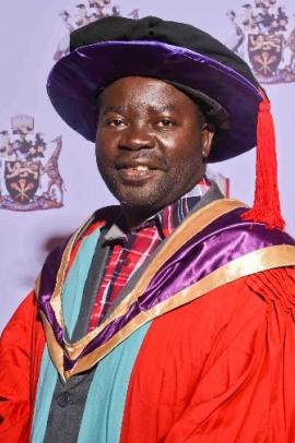
Kiragu Henry Macharia
kiragu

Henry Macharia Kiragu graduates with a PhD in Electrical and Electronic Engineering during the 63rd Graduation ceremony of the University of Nairobi on 25th September, 2020. Kiragu is a Lecturer at the Multimedia University of Kenya in the department of Electrical and Communication Engineering. He has taught undergraduate students in the areas of: Signals and Systems, Digital Communication, Antenna Engineering and Microprocessors. He has also served as the Academic Trips Coordinator for the Faculty of Engineering of Multimedia University for five years from 2014 to 2019. From the year 2004 to 2009, Kiragu was a lecturer at the Kenya College of Communications Technology (KCCT) in the Access Networks Section. 

He received his Masters in Electrical and Electronic Engineering degree from the University of Nairobi in 2013 and a Bachelor of Technology in Electrical and Communication Engineering from Moi University in 1994. He has also undergone practical training in Telecommunication Outside Plant Techniques in Kitakyushu, Japan and is registered as a Graduate Engineer by the Engineers Board of Kenya (EBK). His research interests are in the fields of: Image Processing, Mobile Communication Channel Estimation, Radio Propagation and Optical Communication.

Project Summary

Acquisition and Reconstruction of Sparse Magnetic Resonance Images Using Compressive Sampling Methods

Research Supervisor

Prof. Elijah Mwangi, Dr. George Kamucha

Magnetic Resonance Imaging (MRI) has some attractive advantages over other medical imaging techniques. Its widespread application as a medical diagnostic tool is however hindered by its lengthy acquisition time as well as reconstruction-related artifacts. Magnetic Resonance (MR) images are usually sparse or compressible in the Discrete Wavelet Transform (DWT) or the Discrete Fourier Transform (DFT) domains. The two problems associated with MRI can therefore be solved using Compressive Sampling (CS) methods. In this thesis, seven proposed algorithms that utilize the CS theory to addresses the limitations of conventional MRI are presented. Each of the proposed method exploits the compressibility of the MR images to reconstruct them from only a few incoherent measurements. The Peak Signal to Noise Ratio (PSNR) as well as the Structural SIMilarity (SSIM) measures have been used to assess the performance of the proposed methods. Computer simulation results demonstrated that the proposed methods reduce the reconstruction artifacts and noise by between 1.2 dB and 1.75 dB for a given percentage measurement. Among the proposed methods, the one that yields the best results is the one referred to in the thesis as selective acquisition and artifacts suppression. This method involves acquisition of an under-sampled k-space by employing a smaller number of phase encoding gradient steps than that dictated by the Nyquist sampling rate. The MR image reconstructed from the under-sampled k-space is then randomly sampled and reconstructed using the Orthogonal Matching Pursuit (OMP) greedy method in the DWT domain. To improve the robustness of the method, a proposed apodization function is then used to suppress the reconstruction artifacts. Simulation results based on MATLAB show that this proposed method reduces the concomitant artifacts by 1.75 dB for a given percentage measurement. This quality improvement has been shown to translate to approximately 20% reduction in scan-time compared to other reported CS-based MRI techniques for a given reconstructed image quality

Links

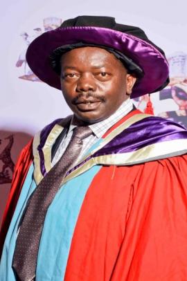
Sabina Nyoroka Baariu

Sabina

Name: SABINA NYOROKA BAARIU

Dip. (Kenya Polytechnic), Higher Dip. (KISM), B.Sc. (KU), M.Sc. (UoN), PhD (UoN): MISK

Contact Information: P.O Box 368-00618, Nairobi, Kenya.  Mobile: +254 722 302 805    E-mail: sbaariu@yahoo.com and sbaariu09@gmail.com

Gender: Female

Marital Status: Married

Nationality: Kenyan

Membership of Professional Bodies: Full Member (MISK)-Institution of Surveyors of Kenya (ISK), Chapter of Geospatial Information Management Surveyors

Career progress and experience:                                        

January 2016 to date        Part-time Lecturer, University of Nairobi (Department of Geospatial and Space Technology)

April 2013 to date            Cartographer/GIS specialist at Rural Electrification and Renewable Energy Corporation

Nov. 1993 -April 2013     Cartographer at the Min. of Lands (Survey Department)

Personal summary: I am a mature, self-driven and dedicated professional Geospatial expert, who always strives to achieve the highest standards at any given task. I possess strong academic qualifications, significant management and leadership experience, extensive technical and professional skills. I enjoy learning new things. I am self-driven, patient, a fast learner and a team player.

Achievements

TVET Curriculum Development, Assessment and Certification for Cartography, GIS and Land surveying

Project Summary

Analysis and Modelling of Cartographic Services among the East African Community Member States

Research Supervisors

Prof. Galcano C. Mulaku and

Dr. - Ing. David N. Siriba

Economic and political integration of East Africa has been expanding since its second founding in 2000, more so with the accession of Rwanda and Burundi (2007) and South Sudan (2016). Driven by the provisions of the common market protocol, greater regional integration is foreseen and it is expected to stimulate the demand for cartographic information to support development planning and other applications. The study was accomplished by survey via semi-structured questionnaires. Results revealed a lot of historical commonalities among the original member states. Due to the fact that these cartographic service shortcomings are at different levels in the different EAC countries, it was proposed that the first step towards their regional improvement be their harmonization, so that they are largely at par. A design of this harmonization has been done, and it is estimated to take 36 months and to cost USD 45 million. The resulting harmonised EAC model was then compared to the European EuroGeographics service. The comparison yielded gaps, and an upgrade design to fill the said gaps has also been carried out. It is estimated to take 60 months and to cost USD 23 million. It is concluded that even though these costs are large, the benefits of such a regional improvement exercise would by far surpass the costs, as 80% of decision making involves geo-spatial data. This study has contributed a hard-to-find body of knowledge on the EAC cartographic services and provided a roadmap for their harmonization, then improvement to the state of the art.

Links

Dickens Onyango Odeny

dickens

Dickens Odeny is a Research Scientist at the National Museums of Kenya at the Center for Biodiversity. He graduated with the Bachelor of Environmental Science at Kenyatta University in 2003. He received the Erasmus Mundus Scholarship in 2004 for the European Joint Master in Water and Coastal Management at the university of Algarve (Portugal) and the University of Plymouth (UK) which he completed in 2006. Dickens was employed at the National Museums of Kenya in 2007 at the Center for Biodiversity under the Wetlands and Marine Programme. During this period he developed great interest in studying spatial ecology and climate change. Due to this, he pursued a short course on Geoinformatics that was supported by the Government of Netherlands under Nuffic Scholarship in 2009. Dickens later on pursued a PhD study in Geographic Information System at the University of Nairobi (Department of Geospatial and Space Technology) with the support of Climate Change Impacts on ecosystem Services and Food Security in Eastern Africa (CHIESA-ICIPE) funded by the Finnish Government in 2012. His research interests are on spatial analysis, biodiversity, carbon sequestration and climate change.

Project Summary

Spatial modeling of biodiversity and carbon storage along the inhabited slopes of mount Kilimanjaro (Tanzania) and Taita Hills (Kenya)

Research Supervisors

Prof. Faith Karanja (University of Nairobi),

Prof. Rob Marchant (University of York) and

Prof. Petri Pellikka (University of Helsinki)

The East Africa Mountains plays important role on sustaining plant diversity and carbon storage in the region. The distribution of the woody plant species and carbon in mountain areas are determined by physical conditions. Due to suitable climatic conditions and fertile soils, agricultural activities have increased and intensified over period of time. This has potentially threatened the vegetation and amount of carbon storage on the inhabited slopes of the mountains. The main aim of the research was to understand the influence of physical conditions, soil factors and cropland systems practiced on the slopes of the two mountains on the distribution of woody plant species and carbon storage. In addition, it assess the interaction of climate change with the woody plant species and carbon storage.

Findings indicate distribution of vegetation and carbon storage are affected differently in croplands. Taita Hills has more woody plant species while the slopes of Mount Kilimanjaro has more carbon storage. Physical variables influence the distribution of vegetation and carbon storage on the slopes of Taita Hills but soil factors seems to affect the distributions in Kilimanjaro.  In the event of climate change most species will respond by shifting upslope. Mount Kilimanjaro will be affected adversely by the upshift of the species than Taita Hills. The upshift will affect adversely certain species and their associated carbon storage. Species like Mango tree will however shift downslope which will see suitable area of distribution increasing in the region. An effective crop management systems is required for improving carbon sequestration in croplands. While adoption of carbon sequestration programme in the region should rely on species that will increase in suitable areas in East Africa.

Links