Masters Graduands

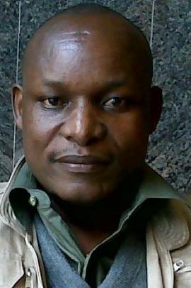
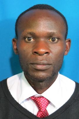
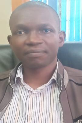
KITHUI Lydia Mwari

KITHUI Lydia Mwari

I am Kithui Lydia Mwari from Nyeri County. I am married with two beautiful daughters Joy and Peace.

I have Studied Masters of Science in Geographic Information Systems from University of Nairobi [2018 – 2020].

I am a holder of a Bachelor’s Degree in Land Surveying from Technical University of Kenya [2013 – 2015] and Diploma in Land Survey from Kenya Institute of Surveying and Mapping [2006 – 2008].

Project Summary

CREATING A LAND INFORMATION SYSTEM IN KAMITI/ANMER BLOCK 4, KIAMBU.

A Land Information System (LIS) is a computer-based information system that enables the input, storage, management, analysis, output and dissemination of geographically referenced parcel-based data and information that is mainly at large mapping scales.

In Kenya, most of the land records are maintained in paper-based, manual form. This system of manual record keeping and maintenance is slow, cumbersome and inefficient, as the records exist in paper form thus the

storage, access and retrieval process is a challenge.

The project aims to show how LIS supports processes such as ownership, land valuation and land use. The main objective of the research is to create a LIS, supported by a geo-database that combines both non-spatial and spatial features of land parcels.

The methodology encompasses identification of spatial and non-spatial data, data collection, data processing and verification i.e., georeferencing, digitizing and topology, and finally the creation of a geo-database.

Kamiti/Anmer Block 4 estate, which is a part of Kiambu town, was used as a case study. Kiambu County has an urban population of 88,869 as of the 2019 census. Kiambu town is the capital of Kiambu County, which bounds the northern border of Nairobi.

A number of results were obtained from this study, namely; a designed database in Microsoft Access, a land use map, a cadastral map of the area of study showing parcels and their acreage, integrated database from Microsoft Access and ArcGIS software, and an overlay of cadastral data with road networks.

The study demonstrates the ease with which information can be retrieved using a digital LIS as opposed to the cumbersome manual-based process that is costly and error-prone. A number of queries were performed using the structured query language to illustrate the ease of access of information. Survey plan data such as area, spatial data and associated land information such as value, rates, rent, land-use and ownership were used to create the LIS database system.

The study concludes that the system provides reliable and easy system for collecting information, analysis, retrieval and updating pertaining to any particular plot of land, which is invaluable for efficient land management in Kenya.

The project should be extended to cover the whole of Kiambu County and later to the other counties of Kenya to be used to digitize and manage large datasets. The LIS across counties should be networked to enable sharing of data and reduce redundancy.

Research Supervisors

Dr. Collins Mwange

ONYANGO Peter Hongo

ONYANGO Peter Hongo

ONYANGO, Peter Hongo is a Senior GIS Officer at the Kenya Wildlife Service (KWS) in Nairobi, Kenya. He deals with data mobilization and organization to enhance wildlife conservation and wildlife policy development. Prior to joining KWS, Peter worked as a Consultant at UNDP – Somalia in the SWB Department. He was involved  in data quality assurance by accurate geospatial data input and processing. Peter has also worked as a GIS Assistant for Regional NGO called African Conservation Centre (ACC) in Nairobi. At KWS and ACC, Peter has been involved in community resources data collection using space technology, data analysis and quality thematic mapping. He holds an MSc degree in GIS from University of Nairobi, degree of Bachelor of Technology in Geoinformatics from the Technical University of Kenya (TUK) and a Diploma in Cartography from former Kenya Polytechnic, now TUK. He has also attended training in Wildlife Management Planning for Biodiversity by GIS and  Remote Sensing in Japan; and training in Discovery, Exploration and Exploitation of Free Data and Tools for supporting the Mitigation of and the Adaptation of Agriculture and Forestry to Climate Change in Belgium. Peter is a member of Institution of Surveyors of Kenya, Geospatial Chapter. He is also a Global Biodiversity Information Fund (GBIF) mentor in data Mobilization and Organization.


Project Summary

MAPPING THE FLOODING OF LAKE NAKURU NATIONAL PARK AND ITS EFFECTS ON RESIDENT WILDLIFE

Lake Nakuru National Park (LNNP) covers an area of 188 km2 and is fully enclosed with  a comprehensive perimeter fence. The park is a home to 56 different species of mammals, 550 plant species, and 450 species of terrestrial birds as well as flamingos and other water birds. The park is flooded and the lake coverage increased from initial  31 km2 in 2009 to 54 km2 in 2018. This impacted negatively on the available space for wildlife. The park infrastructure including some park roads, main gate and the park headquarters were submerged in the floods. This would require a substantial amount of financial resources for rehabilitation.  The floods reduced water salinity and this disturbed the water pH balance that helped growth of blue-green algae which formed the bulk of the flamingos’ food. This made flamingos to migrate from Lake Nakuru to other places. Flamingos made the largest attractant to tourists in LNNP and their absence led to decline in tourist numbers impacting negatively to the national economy. The study provided data and information such as the current flood zones, change in land cover including acreages, flooded wildlife habitats, the infrastructure submerged in water, and the affected wildlife species and their new residents. These data and information could be used to mitigate future climate variability impacts on wildlife. The tools, equipment and data used included a computer, a laptop a Global Navigation Satellite System (GNSS), satellite images, topographical sheets, wildlife census blocks and wildlife statistical datasets.

The overall objective of this research project was to investigate the effects of flooding to wildlife and their habitats in Lake Nakuru National Park. GIS softwares such as ArcGIS 10.6, QGIS, and excel were used to carry out data analysis and development of thematic maps. The Exploratory Spatial Data Analysis (ESDA) that involved the use of a number of techniques to describe and visualize spatial distribution, discover patterns of spatial association, and also to identify hotspots were used. Some of the results included wildlife distribution maps before and after the floods, land cover change maps and wildlife displaced habitats among others.  Key words: Lake Nakuru National Park • Flooding effects to resident wildlife • wildlife displace habitats • Land cover change • Choropleth mapping technique

Research Supervisors

Prof. Galcano Canny Mulaku

LUWAGA Denis

LUWAGA Denis

I am a disciplined and hardworking person with a good and practical academic background. I have learned to succeed from numerous life experiences. I am social, easy to get along with and fast in adjusting to various environments and community demands. I have developed managerial, GIS & ICT Support, Project Management, and Teaching Skills over the years which I am willing and ready to apply so as to meet the organization’s goals and objectives.

Project Summary

Developing a Spatial Risk Assessment Model for the proposed East African Crude Oil Pipeline (EACOP)

A well thought out risk assessment process enables asset owners and stakeholders to carry out effective and efficient risk management by providing specific actions that can reduce the likelihood of risk. The intention is to minimize risk to the lowest practical level such that no unacceptable risks can be realized. Whereas an impact assessment was carried out for the proposed East African Crude Oil Pipeline (EACOP), it doesn’t exhaustively point out all the potential risks associated with the pipeline. This study thus, focused on developing a spatial risk assessment model for enhancing the security and safety of the pipeline through identifying and incorporating other potential risk factors like terrorist attacks, political violence, social unrest, theft, floods and earthquake.  The study also identified the following as vulnerable elements that are likely to be impacted by the pipeline: Populated areas, major infrastructure, Vegetation, Surface Water and Fauna.

The study used Cova’s proposed approach of 1999 to model Hazard, Vulnerability and Risk. Risk was modeled as a combination of Hazard and Vulnerability (Risk = Hazard x Vulnerability) to generate the Hazard, Vulnerability and Risk maps as primary outputs of the study.

The results of the study indicate that the section of the pipeline that traverses through Uganda is at high risk (5) of terrorist attacks and political violence than in Tanzania (3) due to power struggles and political instabilities in the region. The section of the pipeline that traverses through Ugandan districts of Hoima, Kikuube, Kyankwanzi and Kakumiro is at high risk (4) of earthquake due to major faults associated with the East African Rift System, and the part that traverses through Tanzanian districts of Kiteto, Kilindi, Kologwe and Tanga is prone to floods (4) due to the low underlying elevation. Furthermore, the western and central regions of Tanzania are prone to theft (4) and vandalism due to the thick vegetation in form of forests and swamps that exist in the area.

The study presents the potential damage that may be realized along the pipeline as follows: approximately 9,149 people in 26 towns, 96 sections of highway and major roads in close proximity to the pipeline, up to 265,504 hectares of forest cover and grassland could be at risk in the event of a fatality. 

The study proposes the following mitigation measures in order to avoid or reduce on the likelihood of risk events: establishment of police posts in areas of high risk, pipeline insurance, use of ground patrols and UAVs to regularly monitor the pipeline.

In conclusion, the results of the study concur with the ESIA report however; there are other potential risk factors such as fire outbreak, landslides, spillage, corrosion, volcanoes, and cyber intrusion among others that also need to be mitigated.

Research Supervisors

Dr. Ing. David N. Siriba

Brian Sabwa

Brian Sabwa

I am SABWA Brian I was born on 1/11/1988 in Nairobi, Kenya. My parents are William and Joyce Omido, and I am married.

I study Master’s program in Geographic Information Systems in Nairobi University (2018 - 2020),a former student at Jomo Kenyatta University of Agriculture and Technology 2008 - 2011 and I got KCSE  certificate from Alliance High School (2002 to 2005) ,Primary schools (1994-2001) Mululu Primary School.

I speak English and Swahili. I have knowledge on Web Mapping using commercial and FOSS software, Management and Operations of Continuous Operating Reference Systems (CORS) operations, Global Navigation Satellite Systems (GNSS), Geodesy Engineering Survey, Geographic Information Systems, Remote Sensing and Project Management.

Further, I worked lead trainer in GIS and Web mapping For Regional Centre of Mapping of Resources for Development (RCMRD) from 2015-2016, and InterGovernmental Authority for Development(IGAD) from 2014 to 2017 where I trained personnel in all IGAD member states which include Djibouti, Ethiopia, Eritrea, Kenya, Somalia, Sudan, South Sudan and Uganda.

 And Currently am the National Manager operating the new and Nationwide Continuous Operating Reference Systems (CORS), which is a new way of providing survey solutions to Engineers, Surveyors and planners in their day to day activities.

Project Summary

DEVELOPING A WEB MAPPING APPLICATION FOR MANAGING AND VISUALIZATION OF THE LOCATION OF KENYA PORTS AUTHORITY LAND PARCELS IN MOMBASA

In the year 2017 Kenya Ports Authority land audit, it was reported that Mombasa County has 90% of the land parcels used by the agency. The number of parcels allocated and owned by KPA in Mombasa is 171, based on land ownership documents provided by KPA land survey division; the land documents includes certificate of leases and land titles. From the 171 parcel ownership documents, only 65 of the land documents indicated the parcel acreage while 106 documents did not indicate land parcel acreage or were not legible. This research project aimed at filling the gaps in information from the audit report that is important for use and is not readily available on land ownership documents. The web application was developed using Free and Open Source Software (FOSS) web development tools. Tools such as QuantumGIS (QGIS), HyperText Mark-up Language (HTML), Cascading Style Sheets (CSS), GeoJSON, LeafletJS, Apache Tomcat, JavaScript and Open layers, notepad++ were selected for the web application development.

This web mapping application provides a web-based land information system that can be utilized by all stakeholders involved in parcels related activities for Kenya Ports Authority (KPA). The stakeholders include; high level managers, mid-level managers and technicians in constructions within the port The web application provides a user friendly interface that provides quick answers about the physical location, size, perimeter and current use of land. More so the web application allows the user to view additional information such as the current owner of parcels/lessee and market value of the parcels.

Research Supervisors

Dr. Collins M Mwange

Nyadero Felix Arego

Nyadero Felix Arego

I am Nyadero Felix Arego, born on 13TH APRIL 1990 in Siaya, Nyanza Region to the late Josephine Adhiambo and George Nyadero.

I studied Master in Geospatial Information Systems (MSc GIS) in University of Nairobi, Bachelor in Geomatics Engineering and Geospatial Information Systems in Jomo Kenyatta University of Agriculture and Technology, did my O Level (KCSE) education in Maseno School and my A Level in Ndere Boys Boarding Primary School.

I currently work for NatureSurf Systems as a Geospatial Engineer since July 2018, having worked earlier for Kenya National Highways Authority (KeNHA-North Eastern Region) as an Assistant Surveyor from June 2016 to July 2018.

I am single and fluent in oral and written English and Kiswahili. I am a Christian.


Project Summary

Mapping Urbanization and Analysis of its Impact on Quantity of Arable Land. A Case Study of Nairobi City County

Urbanization has been defined as an inter-sectoral trend that directly encompasses all aspects of human civilization and the economy. One of the major drivers of rapid urbanization in Kenya is demographic dynamics. Urban population in Kenya has been on the rise since the inception of census activities in 1897. Based on KNBS findings, it is projected that by 2050, 55% of the entire country’s population will be living in urban areas. Urbanization has had major influence so far on our landscape with most arable lands, protected areas, riparian reserves and wetlands in Nairobi City County paving way for urban developments.

This project employed the use of Remote Sensing and GIS Technologies together with AHP Multi-Criteria decision-making tool in mapping urbanization and analyzing its effect on the quantity of arable land in Nairobi City County. The study delineated and categorized all lands in the county based on their level of suitability for crop farming as Very Highly Suitable, Highly Suitable, Suitable and Low Suitability.

Nairobi City County has undergone rapid urbanization in the past two decades. It’s annual rate of urbanization stands at 5.02% as per the findings of this project during the past two decades. This has had a major impact on the quantity of lands potential for crop farming with an approximate 4,514 Hectares of land having been lost to Built-Up Areas in a time span of 18 years i.e. from 2000 to 2018. This clearly highlights the magnitude of the impact that urbanization has had on the quantity of arable land.

Research Supervisors

Jasper Ntwiga Mwenda

NDUNG’U Stephen Mutura

NDUNG’U Stephen Mutura

I am NDUNG’U Stephen Mutura I was born on 25th/04/1992 in Muguga, Kabete, Kiambu county. My parents are SIMON Ndung’u Mutura and PENINAH Wambui Ndung’u, and I am married.

I study Master’s program in Geographic Information Systems (GIS) in University of Nairobi (2018 - 2020), I got a bachelors of science in Geospatial Engineering from University of Nairobi 2011 - 2016 and I got O’level certification, the secondary school Ngenia High School (2007 to 2010) Primary schools (1999-2006) Muguga Primary School.

I speak Kikuyu, Kiswahili and English. I have knowledge on computer literacy; I can use Microsoft Offices, Internet Explorer, ArchiCAD, AutoCAD civil 3D, ArcGIS and QGIS.

Further, I Work at Kenya rural road authority as assistant site surveyor in various projects such as RCW 126 Ruaka-Banana-Limuru and Thogoto Gikambura-Mutarakwa(phase III), RCW 499, RCW 540, RWC 282 and RWC 574.

Project Summary

INTEGRATION OF ROAD DESIGN INFORMATION WITH CARRYMAP FOR MOBILE ACCESS

Today, technological advancement is a major driving force in changing the face of the spatial information around the world. High spatial resolution satellite imagery has revolutionized the Mapping discipline. The GIS database technology for storage of large datasets, data management, and analysis and update facilities has had the greatest impact on spatial information environment.  This study aims at development of road design and all road features to be displayed in mobile phone application (CarryMap). The study covered Limuru and Kabete constituency’s rural roads, which are under Kenya Rural Roads Authority (KeRRA). The methodology employed in the study involved use of GIS software to develop a database which contains both spatial and non-spatial data. Cadastral maps were scanned, georeferenced, cropped and mosaicked. An overlay with high resolution satellite imagery was done to establish whether there were buildings and other developments that are constructed on the road reserves. Road design with chainage and elevation both   super elevation and camber were overlaid with Kenya New Road Classification Map 2018.


Using AutoCAD application, the Topographical data was imported and plotted. The plotted data was used to create road design, then the road design was imported to ArcMap so that it can be compatible with CarryMap which can be displayed on mobile phone. Using this CarryMap mobile application you can be able to know exact chainage and real-time location while in the field.  Static survey was performed to connect all the roads to the National Control Network. The project has demonstrated the benefits of integrating Remote Sensing, Cadastral Survey and Geographic Information Systems approach in Land Management and Road Construction. This study has demonstrated the use of the CarryMap application as a mobile application that can be used in design and real-time monitoring of road projects.

Research Supervisors

Mr. JASPER NTWIGA MWENDA

OMEKE Omae Jeremiah

OMEKE Omae Jeremiah

I am OMEKE Omae Jeremiah I was born on 07th /07/1988 in Kisii, Nairobi Kenya. I study Masters program in Geographic Information Systems in Nairobi University  (2018 - 2020)

Project Summary

Comparison of UAV Mapping of Settlement Scheme with PIDs/RIMs

A Case study of Nyansiongo Settlement Scheme

The study discusses examining the Parcels digitized from RIMs compared with the Parcels derived from the UAV Ortho-rectified images of the same area. Nyansiongo Settlement Scheme has been used as an example to determine the possible variations that exist between the two different techniques of the survey. It comprises of the acquiring of the RIMs maps from the Survey Office, scanning them to obtain the maps in digital format. The scanned RIM is then imported in the ArcGIS environment to be geo-referenced and then digitized. The parcels that were obtained were then used to be compared with UAV-derived imagery of the same area. The UAV derive Imagery was acquired by first, having reconnaissance in the field that is the Nyansiongo settlement scheme.

In the establishment of control points that were to be used by UAV Technology, the Real-Time Kinematic GPS was used. RTK GPS base was used to establish the control points together with the base CORS-Network at Kisii town station RTCM (Radio Technical Commission of Maritime). The flight planning was done with the PIX4D software for the area of study. Then the UAV that is the Phantom UAV was used to take the aerial survey to capture the imagery of the 5cm resolution of the part of the Settlement scheme that was used in the study. The flight altitude or height was 110m and a sufficient overlap of 75% side overlap and 80% forward overlap. The images that were obtained from the UAV were post-processed using UASMaster software that is automated to generate the Ortho-rectified image of the study area. The Ortho-rectified image from the UAV was digitized in ArcGIS software by overlaying it with the scanned and Geo-referenced RIM to determine the boundary line of the parcels. The UAV digitized parcels were referred to as UAV derived parcels while those from RIM were referred to as Digitized RIM parcels. A shift was identified when the two sets of data were overlaid. That is the UAV derived parcels with that of RIM digitized parcels.

In comparison between the UAV derive parcels with that of RIM digitized parcels a shift in terms of perimeter and area were measured. The shift in the perimeter is 558.31 Meters while as the shift in the area of the same section was 6,080.82Square Meters. This was as a result of the level of technology involved in surveying the same settlement scheme is different. The traditional method used in surveying the settlement scheme involved the use of aerial photography methods; boundaries are marked on the enlarged photographs. Through Photogrammetric processes, RIMs are generated. The UAV technology is of high accuracy and the imagery obtained from it was 5cm spatial resolution as compared with the conventional methods that were used to generate the RIMs.

Research Supervisors

Mr. B. M. OKUMU

Kuto K. Edmond

Kuto K. Edmond

I am passionate with environmental resource mapping, specifically using emerging technologies such as GIS and Remote Sensing for modeling environmental issues, processing time series satellite data using open source algorithms and a variety of GIS software.

My career goal is to promote community development and environmental conservation focusing on agriculture and environment modeling using GIS and Remote Sensing. In addition, I endeavor to make significant contribution to the development of novel algorithms for processing Remote data to support policy development and decision making.

Project Summary

Monitoring Tree Cover Changes in Kenya’s Five Major Water Towers Using Geospatial Technologies

Water towers are the hearts that pump life into any ecosystem by providing fresh water recharge to sustain most living organisms that facilitate the very existence of humans. Numerous studies have documented the importance of these water towers in sustenance of fresh water that account for only about three percent of the Earth’s water. While the role water towers play in ensuring our survival is clear, they are continuously and gradually being degraded as a result of pressure from demographic factors in addition to uncontrollable natural factors. Inadequate information about the area and spatial extents of tree cover loss jeopardizes systematic monitoring of these forests. This has led to haphazard restoration efforts that tend to be unsuccessful in the long term. Earth observation technology enables efficient and effective mapping and monitoring of forest cover within water towers over an extensive range of temporal and spatial scales. This study applied remote sensing techniques to investigate the amount of tree cover lost between 2005 and 2019 in Kenya’s major water towers using Landsat 30-m resolution imagery. The images were classified into two classes, tree cover and non-tree cover, from which change detection maps were produced with their underlying statistics of tree cover loss in terms of area and location. The study established a trend in tree cover loss across all the water towers where Mt. Kenya experienced approximately 7% decline, Mt. Elgon 14%, Aberdare range 18%, Mau complex 24% and Cherangani hills 25% which all amount to an average of 19% throughout the study period. The government and NGOs should therefore apply geospatial techniques in monitoring tree cover. This will enable proper identification of degraded areas within forests and further make informed decisions in formulating policies and executing restoration programmes.

Research Supervisors

Mr. Wakoli Peter C.M.

Kyule Martha Mbenge

Kyule Martha Mbenge

I am a determined, responsible, and self-motivated graduate engineer. I have studied for a Master of science program in Electrical and Electronic Engineering at the University of Nairobi (2016-2020). I have a Bachelor of Science degree in Electrical and Electronic Engineering from the University of Nairobi (2006-2011) and I got Kenya Secondary School certification (2000 to 2004) from Mbooni Girls Secondary School.

I am currently working at Kenya Power (2017 to date) at the network management division. Previously, I worked as an assurance associate and senior associate at Price waterhouse Coopers, Kenya (2011-2016). I undertook Industrial attachments at Kenya Police Airwing (Sept 2010), Power Technics (Aug 2010), Newedge Communications Ltd (Sept-Oct 2008) and Kenya Power and Lighting Company (Aug-Oct 2007).

I am passionate about providing engineering solutions to societal problems. Key interests include: Distributed Generation, Power System automation, Power System Stability, Renewable Energy technology and Optimization.

Project Summary

IMPROVING THE VOLTAGE STABILITY OF A DISTRIBUTION SYSTEM WITH RENEWABLE DISTRIBUTED GENERATION USING A THREE METHOD HYBRID.

Owing to the increased advocacy on clean energy sources worldwide, the integration of Renewable Distributed Generators (RDGs) in to the grid has been increasingly adopted in meeting increased electrical load demand. RDGs are intermittent in nature posing a great problem to the system’s voltage stability due to their variable power output. Therefore the study of voltage stability with Renewable Distributed Generation integrated in the distribution system is very critical in modern power system operation. The formulation and solution of the voltage stability problem of a radial distribution system with Renewable Distributed Generation (RDG) is crucial. Earlier research works show that optimal penetration of RDGs to the grid near the load centers can improve the system reliability, voltage stability and power quality through reduced transmission line losses. However, a further increase in RDG penetration distorts the system’s voltage stability. This thesis work comprised of a multi-objective problem formulation aimed at reducing the total line losses (both real and reactive) and the total voltage deviation of a radial distribution system with Photovoltaic Solar sources and wind sources. A three method hybrid approach of Index Based Planning, Adaptive Genetic Algorithm and Simulated Annealing was applied in solving this problem. Results show that the three method hybrid can be used to optimally size and locate two RDGs in a radial distribution system while reducing the total line losses and total voltage deviation simultaneously.

Research Supervisors

Dr. Peter Musau

Prof. Nicodemus Abungu

CHEPKANIA Terry Lumbasi

CHEPKANIA Terry Lumbasi

Eng. Terry Lumbasi Chepkania graduates with a Master of Science Degree in Electrical and Electronic Engineering during the 64th graduation ceremony of the University of Nairobi on 11th December, 2020. He is a Manager at Rural Electrification and Renewable Energy Corporation (REREC). He is passionate about serving others and has a personal commitment to his family and making use of available opportunities for posterity.

In the past, he served in various roles and capacities with Kenya Power & Lighting Company in Nairobi region and environs for a period of 12 years. Prior to that he worked with Nzoia Sugar Company as Trainee Engineer. He holds a Bachelor of Technology degree in Electrical and Communication Engineering from Moi University received in the year 2005. In 2014, he graduated with a Master of Business Administration in Finance from University of Nairobi. He is a registered professional Engineer with the Engineers Board of Kenya and a Member of the Institution of Engineers of Kenya. He is also a member of Institute of Electrical & Electronic Engineers. His research interests includes renewable energy generation, power system operation and control, distributed generation and grid integration.

Project Summary

INVESTIGATING POWER GRID FREQUENCY STABILITY WITH WIND ENERGY USING PARTICLE SWARM OPTIMIZATION ALGORITHM

Renewable energy sources (RES) have become a key area of concern and interest world-wide, including in Kenya where recently a 310 MW Wind Power plant was commissioned.  They are clean energy technologies, in some cases occur in abundance and can mitigate against rising cost of fossil-fuels. Wind energy conversion technologies, in particular, have witnessed one of the highest growth rates in the energy sector in recent years. However, their continued integration into the utility poses serious challenges with respect to the stability of the electrical power system. They do not inherently provide system inertia from rotating masses of the rotor of the turbine. In fact, it is well documented that large scale integration of wind energy sources into the grid by displacement of the conventional sources of energy leads to frequency instability. This thesis investigated power grid frequency stability with wind energy using particle swarm optimization (PSO) algorithm. The investigation employed MATLAB/Simulink environment, in conjunction with power system analysis toolbox, on an IEEE 39 Bus Test System. The optimization employed PSO algorithm and load flow was conducted using Newton Raphson algorithm. Results obtained show that the voltage profile and frequency response profile improved significantly as the percentage wind penetration increased in the grid. The active and reactive power injections remained constant because the load was assumed constant. For the test system considered, the maximum wind power penetration level was established to be 32.1%. Notably, as the percentage of wind power penetration increased, the rate of change of frequency worsened from 0 % to 33.33 %. This is due to the intermittent nature of wind energy source.

Research Supervisors

Dr.Peter Moses Musau

Prof. Cyrus Wabuge Wekesa.

OJWANG Benson Onyango

OJWANG Benson Onyango

Benson Onyango Ojwang (MSc. EEE, BSc. EEE, Nairobi) is a registered electrical Graduate Engineer by Engineers Board of Kenya (EBK). He is also a licensed electrician by Energy and Petroleum Regulatory Authority (EPRA). Currently Benson is a Graduate Assistant in the Department of Electrical and Information Engineering, University of Nairobi. He specializes in Power Systems and Electrical Machines besides Control Systems. Benson is also an IEEE Young Professional Member. He is the co-chair for IAS/PES IEEE PowerAfrica Conference 2020. He has published many papers with IEEE Xplore and IJSER.

As a trainee engineer, he has worked with Crown Plaza, in the Electrical Department, and Radio Africa Group, in the Broadcast Department. He has also worked as volunteer teacher in California Secondary School; teaching Physics, Chemistry and Mathematics.

As part of community service, Benson is a co-founder and board member of Juhudi Kenya – a non-profit non-governmental organization mandated with eradication of bedbugs in slums and learning institutions. Towards COVID-19 pandemic, he worked with a team from the University of Nairobi to design a ventilator prototype. The production model of the ventilator is on-going.

His research interests include renewable energy generation, power system operation and control, distributed generation and grid integration.

To advance in electrical engineering field practices, Benson has worked with contractors in solarization of community borehole pumping systems and solar street lighting

Project Summary

DEVELOPMENT OF AN ECONOMIC AND ENVIRONMENTAL DECISION MAKING MODEL FOR OPTIMAL SOLAR AND WIND ENERGY UTILIZATION

Since the emergence of renewable energy, Renewable Energy Technology (RET) has been considered harmless, clean and free. On the other hand, non-renewable energy sources are perceived as the only hostile technology to the environment without focusing on the detrimental effect of Renewable Energy Sources (RES). Many people have continued to use this ‘harmless’ technology without considering the long term environmental and economic impacts. It is, therefore, important to evaluate the environmental impacts of solar and wind technologies and decide on the net environmental and economic benefit before utilization. This will ensure optimal utilization while maintaining the quality and availability of natural resources for current and future generations. For a suitable decision from the model, there is need to interrelate social, health, ecosystem, emissions and resource cost effects of solar and wind technology to the environmental and economic impacts. This will improve the judgment on whether or not to deploy the technology depending on the net benefit to the community. In light of the above, in this thesis an Economic-Environmental Decision Making Model (EEDMM) for optimal utilization of solar and wind energy is developed. The simulated results show that solar PV causes reduction in Ozone depletion by 30.15% while wind reduces it by 81.86% as compared to conventional sources. In conclusion, the developed Economic and Environmental Decision Making Model (EEDMM) is useful in providing prior advice to the users on whether or not the utilization of the solar and wind is achieved. The decisions are made from the EEDMM chart.

Research Supervisors

Dr. Peter Moses Musau

Dr. Abraham Mutunga Nyete

OWEN MICHAEL OMONDI

Owen

Owen Michael is an energetic, outgoing and articulate Engineer with good practical experience in the field of water and waste water in the consultancy field. Owen specializes in design, research, supervision and project/contract management. My driving force is “Non Nobis Solum”. Owen is a powerful force in the workplace and uses her positive attitude and tireless energy to encourage others to work hard and succeed as a way of transferring knowledge to the future generation. Owen is inspired daily by those dear to his heart. In his free time, Owen likes to hike, undertaking pro bono activities and play chess, hockey and children.

Project Summary

USE OF URBAN SURFACE RUNOFF FOR GROUNDWATER RECHARGE IN NAIROBI CITY

Surface run-off harvesting systems of collect and store rain-water from rooftops, lawns and street runoffs for later use. While the catchment experiences high run-off in the dry season severe water shortage is experienced. Water crisis keeps looming because of the intense pressure on water resources. Some wells in the upper aquifer within the depth up to 120m below ground level have dried up, indicating depletion.


The objectives of the study were to establish the contribution of groundwater recharge by surface runoff in the mitigation of urban floods in Nairobi. Desk studies were undertaken. Using ArcGIS 10.3 and Boolean Logic function, the parameters of land use cover, slope, geology and vadose zone thickness were analysed, and feasible parameter layer maps were generated. Integration of the feasible parameter layer maps using the Boolean logic function resulted in a feasible area map. The identified feasible areas for groundwater recharge provided for guidelines for planned recharge for the city. To determine urban flood characteristics, Landsat images were used to generate land use cover using ArcGIS. The rate of change in land use was determined. The rational method was used to estimate the run-off potential thus the proportion to be harvested.


Due to non-uniform piezometric level ranging between 30.5m and 120m below ground level, it was evident that the aquifer is multi-layered. 22.57% of the area was found feasible for the planned recharge of the aquifer. For the analysed land use, the available runoff potential proportion was found to be 47.26%. The runoff potential is fundamental as all this water can be channelled to the artificial groundwater recharge. The run-off thus showed the potential of augmenting groundwater in the dry season. The greatest most remarkable outcome will be a reduced rate of aquifer depletion. This is achievable by the implementation of stormwater harvesting to increase groundwater recharge. The study showed a co-benefit of flood mitigation.

Supervisors

DR. SIMEON DULO

DR. CHRISTIAN THINE

CHIRCHIR Rodgers Ignatius

chirchir

A Renewable Energy and Energy Efficiency Enthusiast with Four years’ work experience in the Energy Sector. Currently working at the Energy and Petroleum Regulatory Authority as an Energy Efficiency Officer. I am a self-motivated and goal driven team player with strong positive attitude. I have participated in the development of various regulations that are currently governing the Energy Sector in the country.

Project Summary

Performance Assessment and Analysis of Energy Saving Mechanisms and Impact of Introducing Free Cooling Technologies on Base Transceiver Stations

Organizations have increasingly ventured into ways of optimizing available energy through integration of energy efficient approaches in respective operations. Communication sector has developed into major energy consumer. According to the studies conducted, energy consumption patterns within the industry indicate that more than 40% of energy is taken by cooling of base station equipment (BTS). Recently, service providers in the industry have shifted from traditional cooling systems that employ conventional air conditioners to more energy efficient approaches like integrating free cooling system. However, previous studies have not shown applicability and viability of the approach apart from the theoretical perspective of reduction in energy usage. Therefore, this study aimed to investigate the performance in terms of energy efficiency, savings in operating cost, and environmental impacts the new approach has in relation to conventional cooling system. Using Energy Data Logger and a Temperature logger, data from four BTSs within Nairobi region were collected and analysed statistically. The study found out that, the free cooling technology resulted in direct energy savings of approximately 4,842.455 kWh per year, which translated to a carbon dioxide emission reduction of 1.598 tons annually, and savings of Ksh 109,487 per station. The study did not take into account the number of hours’ backup generators were in use but rather considered grid electricity supply during savings calculations. This study therefore recommends the use of free cooling technology to reduce energy consumption of mechanized cooling techniques available.

Reference

Sun, X., Zhang, Q., Medina, M.A. and Liao, S., 2015. Performance of a free-air cooling system for telecommunications base stations using phase change materials (PCMs): in-situ tests. Applied energy, 147, pp.325-334.

Research Supervisors

Prof. James Nyang’aya and Dr. Richard K. Kimilu